- Joined
- Nov 17, 2023
- Messages
- 550
- Reaction score
- 6
- Points
- 18
- Location
- uk
- Website
- oneddl.net
- NullCash
- 15,461

Free Download Aquaveo Groundwater Modeling System (GMS) 10.7.7 | 1.4 Gb
Owner:Aquaveo
Product Name:Groundwater Modeling System (GMS)
Version:10.7.7 Premium
Supported Architectures:x64
Website Home Page :www.aquaveo.com
Languages Supported:english
System Requirements:Windows *
Size:1.4 Gb
Aquaveo, a water resources consulting company, is pleased to announce availabilityGroundwater Modeling System (GMS) 10.7.7is the most advanced software system available for performing groundwater simulations in a three-dimensional environment.
What's New in GMS 10.7.7 - December 01, 2023
MT3DMS
- 14669 MT3DMS Basic Transport Package doesn't retain table
MODFLOW6
- 14678 "First Order Decay" Option in the MDT Package for MF6 is Printing the Flag Wrong
- 14796 Error when creating datasets from mf6 cbc file
Cross Sections
- 14681 When Multiple Cross Sections are Shown in the Editor, Only One is Editable
GIS
- 14033 Texture map issue - resolution too low, rips
MODFLOW
- 14718 Wrong MODFLOW used when choosing DRT from right click menu
- 14751 GUI Test: Crash when opening MODFLOW Optional Packages
- 14752 Mapping MNW2 Coverage with Invalid Well Screen Crashes GMS
UGrid
- 14539 Refining Quadtree Cells Causes an Error Message, But Still Seems to Work Correctly
- 14586 Deleting a Ugrid Cell Causes the "Single Layer" Checkbox to Disappear
- 14713 Splitting Layers on a Ugrid Causes it to Stop Appearing in "Single Layer" Mode
MODFLOW-USG
- 14795 USG-Transport model runs with GSI executable, but not H5 executable
Export
- 14843 Crash when exporting shapefile
Contours
- 14828 GMS 10.7: "Fill continuous color range" is disabled for Block Fill contours
File IO
- 14792 Specific shapefile cases crash in 13.3 but not 13.2
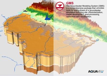
TheGroundwater Modeling System (GMS)is a comprehensive graphical user environment for performing groundwater simulations. The entire GMS system consists of a graphical user interface (the GMS program) and a number of analysis codes (MODFLOW, MT3DMS, etc.). GMS was designed as a comprehensive modeling environment. Several types of models are supported and facilities are provided to share information between different models and data types. Tools are provided for site characterization, model conceptualization, mesh and grid generation, geostatistics, and post-processing.
GMS
Instructional videos for the Groundwater Modeling System (GMS) program developed by Aquaveo.
Aquaveois a pioneer of GIS-based software solutions for hydraulic, hydrologic and groundwater modeling. Our products have been refined over two decades to create the most advanced environmental modeling and visualization software available. In addition to interfacing with industry standard numerical models, we develop custom desktop and cloud-based applications tailored to specific needs. Aquaveo began as a part of the Engineering Computer Graphics Laboratory at Brigham Young University in 1985. The lab was reorganized and the name was changed in September, 1998 to the Environmental Modeling Research Laboratory (EMRL). In April, 2007, the main software development team at EMRL entered private enterprise as Aquaveo, LLC.
Rapidgator-->Click Link PeepLink Below Here Contains Rapidgator
http://peeplink.in/5bfbbc0d9637
NitroFlare
jsc78.SETUP.rar
Uploadgig
jsc78.SETUP.rar
Fikper
jsc78.SETUP.rar.html
